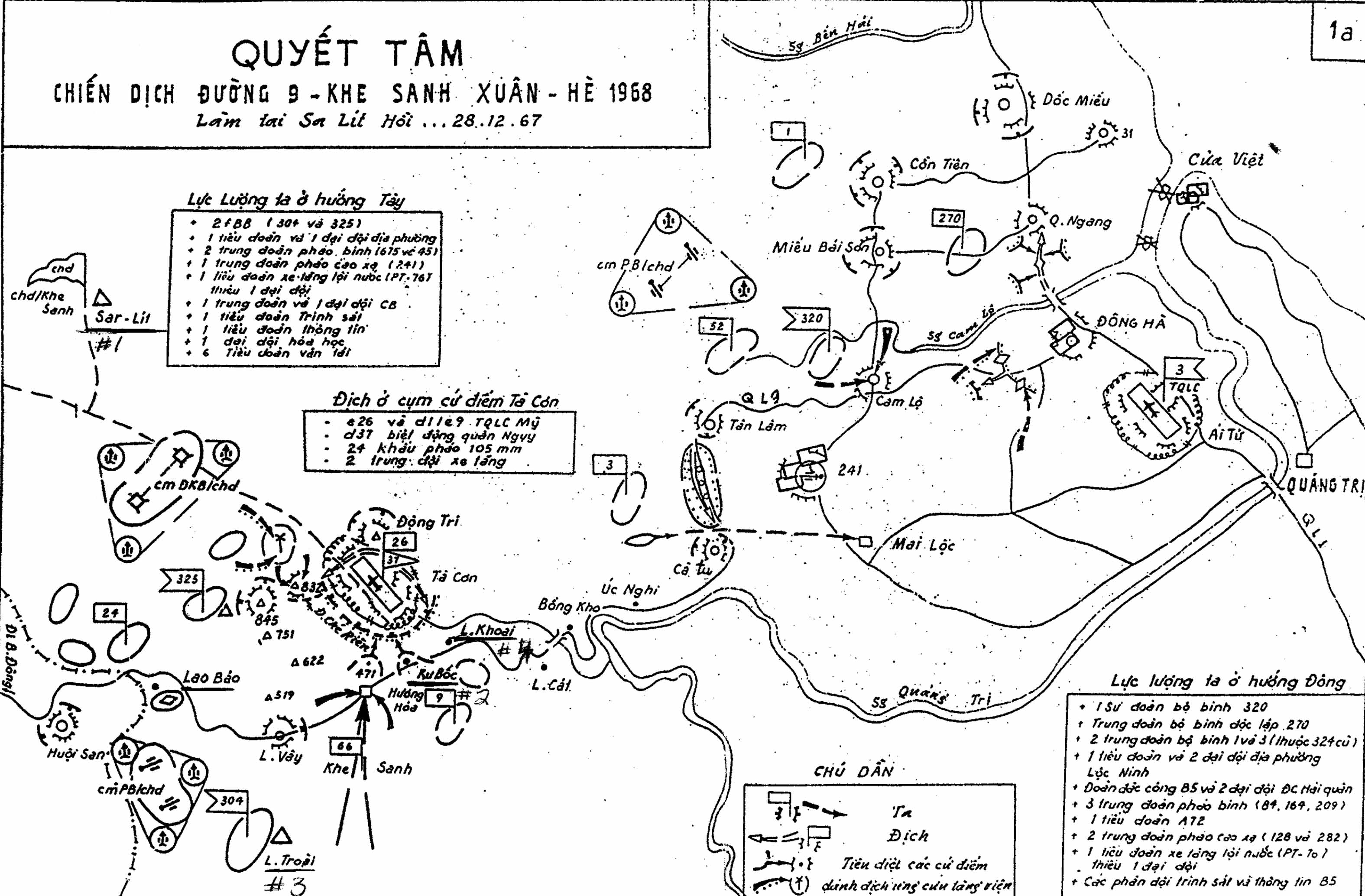
Thought it might be interesting to look at. It's hand drawn (not to scale) of NVA positions in late 1967 and early 1968 from the East coast to Laos along the DMZ.
What's interesting is the loction of NVA units & Camps in proximity of our Camps
( We were neighbors, yet never really got to know each other )
Below is the American translation of what is in the color coded boxes
Our Forces at the West
2 f (???) Infantry (304th and 325th)
1 Battalion and 1 Company of Local Force
2 Artillerty Regiments (675th and 45th)
1 Anti-Aircraft Artillery Regiment (241th)
1 Armor/Tank Battalion (PT-76) without 1 Company
1 Engineer Regiment and 1 Engineer Company
1 Scouting/Intelligence Battalion
1 Signal Battalion
1 Chemical Company
6 Transportation Battalions
Enemy at Ta Con Bases
C26 and D11C9 American Marine
D37 Vietnamese Ranger
24 of 105mm Cannons
2 Armor/Tank Platoons
Our Forces
Enemy
Destroy those Bases
Attack the reinforcement of the enemy
Our Forces at the East
320th Infantry Division
270th Infantry Independant Regiment
2 Infantry Regiments: 1st & 3rd (part of the former 324th)
1 Battalion and 2 Companies of Loc Ninh local force
The "Special Force" B5 & 2 Companies of Naval "Special Force"